Where the water flows
The water management system of historic Angkor
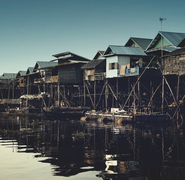
Kampong Phluk in Tonle Sap lake
Where the Water Flows: The Rise and Fall of Angkor’s Water Management System
The ancient city of Angkor in present-day Cambodia stands as one of the greatest achievements of premodern urban civilization. At the heart of Angkor’s success was not only its monumental temples, such as Angkor Wat and Bayon, but also a vast and sophisticated water management system. This system controlled, stored, and distributed water across the landscape, supporting agriculture, religious life, and political power. Understanding how this system worked—and why it eventually failed—offers important insight into the history of Angkor and the fragile balance between human societies and their environment.
Angkor rose to prominence between the ninth and fifteenth centuries as the capital of the Khmer Empire. The region experiences strong seasonal contrasts, with intense monsoon rains followed by long dry periods. To thrive in such conditions, the Khmer rulers invested heavily in hydraulic engineering. Water was not merely a resource; it was a symbol of divine kingship. Khmer kings presented themselves as god-kings who could bring order to the land, and controlling water was a visible sign of that power.
The water management system of Angkor was vast, complex, and carefully planned. It included enormous reservoirs called barays, extensive networks of canals, embankments, moats, and ponds. The largest of these reservoirs, such as the East Baray and the West Baray, stretched several kilometers in length. These structures captured monsoon rainfall and river water, storing it for use during the dry season. Canals then distributed water to rice fields, ensuring multiple harvests and supporting a large population.
Rice agriculture was the foundation of Angkor’s economy. By regulating water flow, farmers could increase productivity and reduce the risks of drought or flood. The surplus food supported not only the population but also the construction of temples and the maintenance of a powerful state. In this way, water management was directly tied to Angkor’s political stability and cultural achievements.
However, the very complexity that made Angkor’s system so effective also made it vulnerable. Over time, the network expanded as new rulers added canals, reservoirs, and temples. This growth may have reduced the system’s flexibility. Maintenance became increasingly difficult, requiring constant labor and centralized control. Sediment buildup in canals and reservoirs demanded regular clearing, and failures in one part of the system could affect many others.
Environmental change played a major role in the system’s collapse. Scientific studies of tree rings and sediments suggest that Angkor experienced periods of extreme climate instability in the fourteenth and fifteenth centuries. Long droughts were followed by episodes of unusually heavy rainfall. During droughts, reservoirs and canals could not supply enough water. During intense monsoons, embankments and canals were damaged or destroyed by floods. The system, designed for relatively predictable seasonal patterns, struggled to cope with these extremes.
Human factors also contributed to the collapse. As Angkor grew, deforestation increased to make way for agriculture and construction. This led to greater soil erosion, which clogged canals with sediment and reduced their effectiveness. Political challenges further weakened the system. Internal conflicts, shifts in trade routes, and external pressures—particularly from neighboring states—reduced the resources available for large-scale maintenance. When central authority weakened, the coordinated labor required to manage the water system likely declined as well.
By the fifteenth century, Angkor was gradually abandoned as a political center. While people did not disappear from the region, the great urban core could no longer be sustained. The failure of the water management system did not happen suddenly, but through a combination of environmental stress, infrastructural overload, and political change.
The story of Angkor’s water system is both inspiring and cautionary. It shows how human ingenuity can transform a challenging environment into a thriving civilization. At the same time, it reminds us that even the most advanced systems depend on careful maintenance, stable governance, and respect for environmental limits. Where the water once flowed smoothly through Angkor’s canals, it carried the lifeblood of an empire. When that flow was disrupted, the foundations of the civilization itself began to erode.
Kampong Phluk in Tonle Sap Lake
Life on the Water: Kampong Phluk and the Rhythm of Tonle Sap
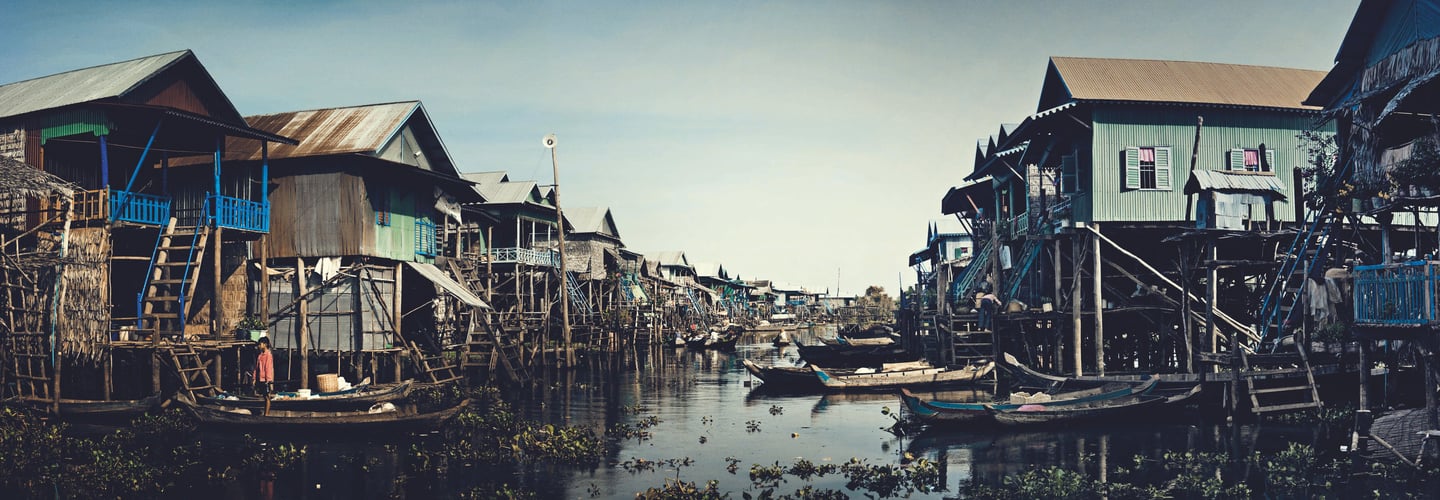
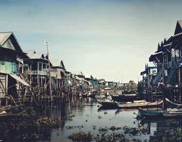
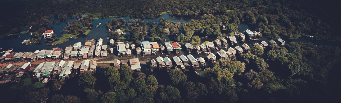
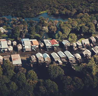
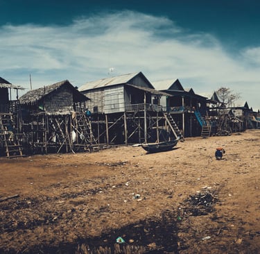
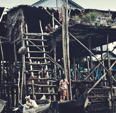
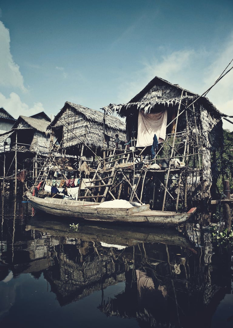
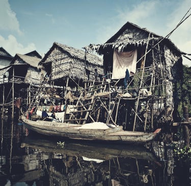
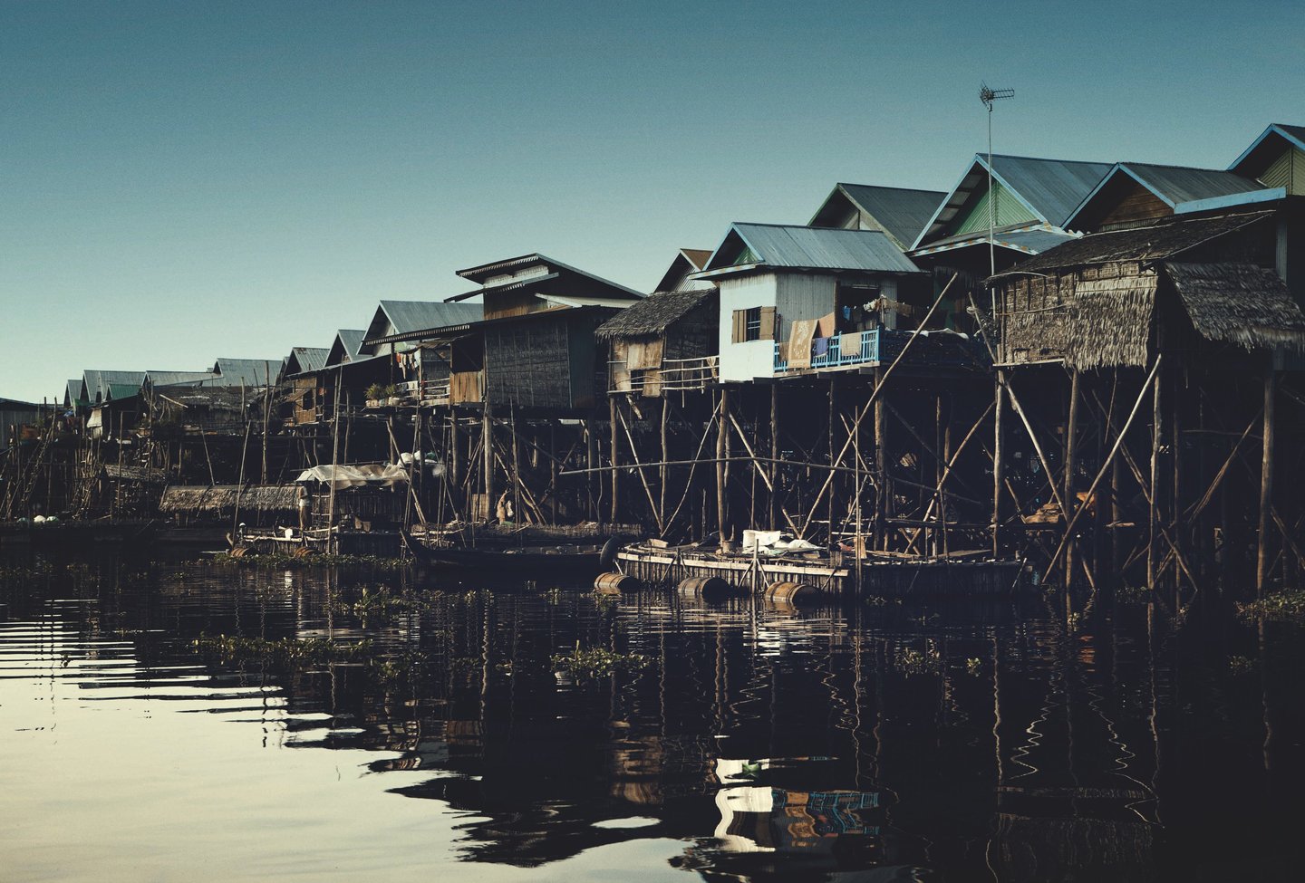
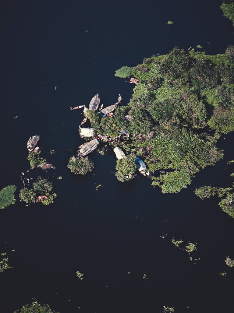
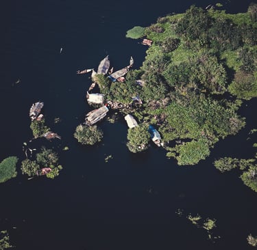
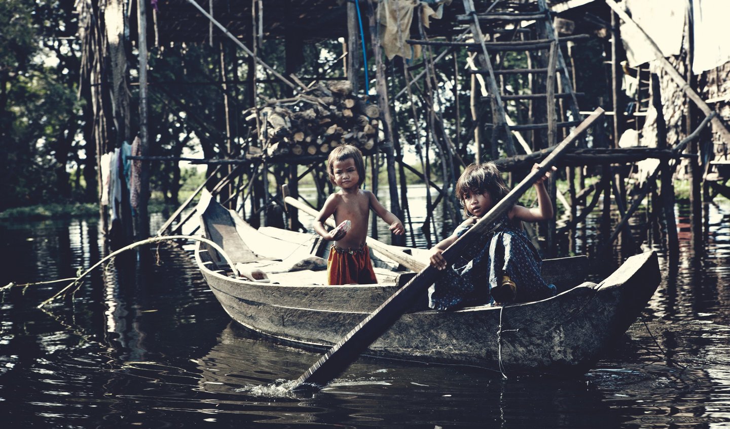
Kampong Phluk is a remarkable village located on the edge and within the floodplain of the Tonle Sap Lake in Cambodia. Unlike many rural communities that are built on solid ground, Kampong Phluk exists in a landscape shaped entirely by water. Each year, the village is flooded during the rainy season, and daily life follows the natural rhythm of the lake. The people of Kampong Phluk have adapted to these conditions over generations, creating a unique way of life centered on fishing, community, and resilience.
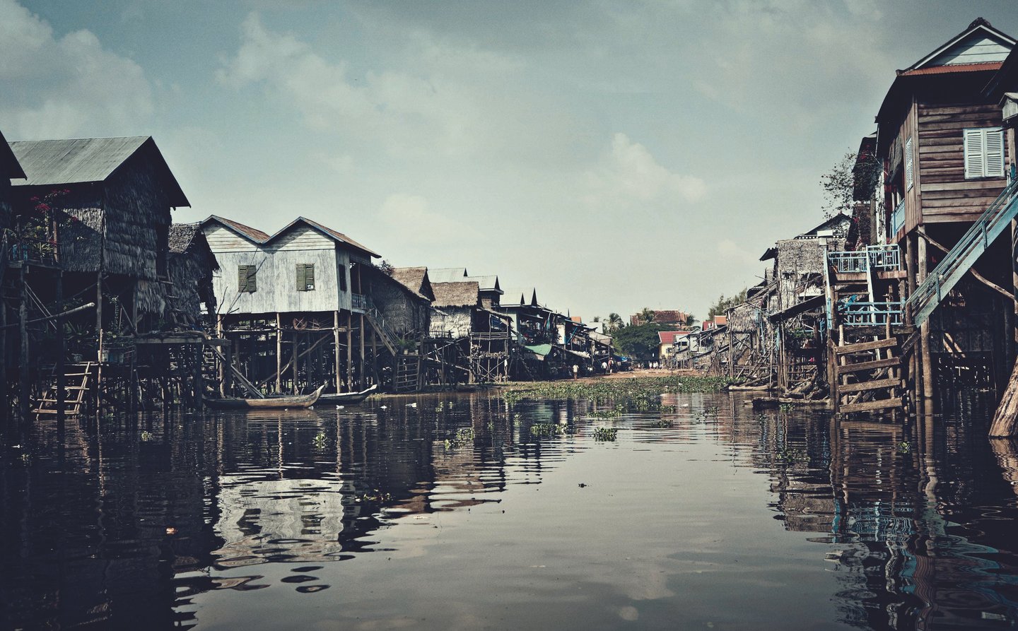
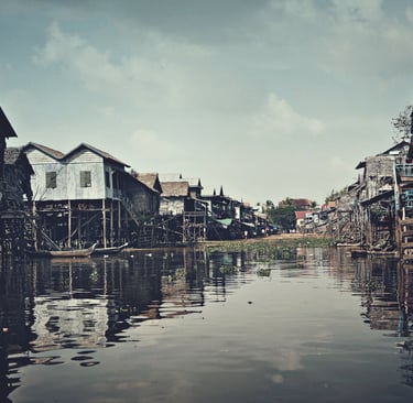
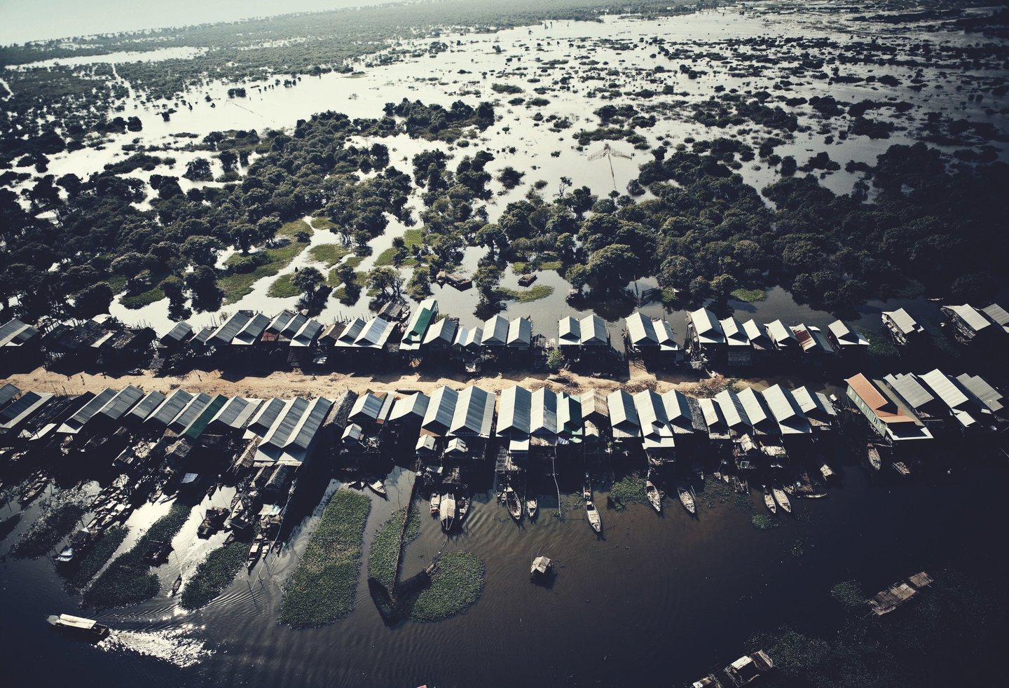
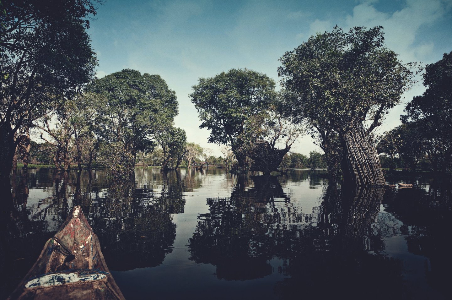
Tonle Sap is the largest freshwater lake in Southeast Asia and plays a vital role in Cambodia’s environment and economy. During the monsoon season, from roughly May to October, the Mekong River pushes water back into the lake, causing it to expand dramatically. Water levels can rise several meters, transforming fields and forests into a vast inland sea. Kampong Phluk lies in the middle of this changing landscape, making flooding not a disaster but a normal and expected part of life.
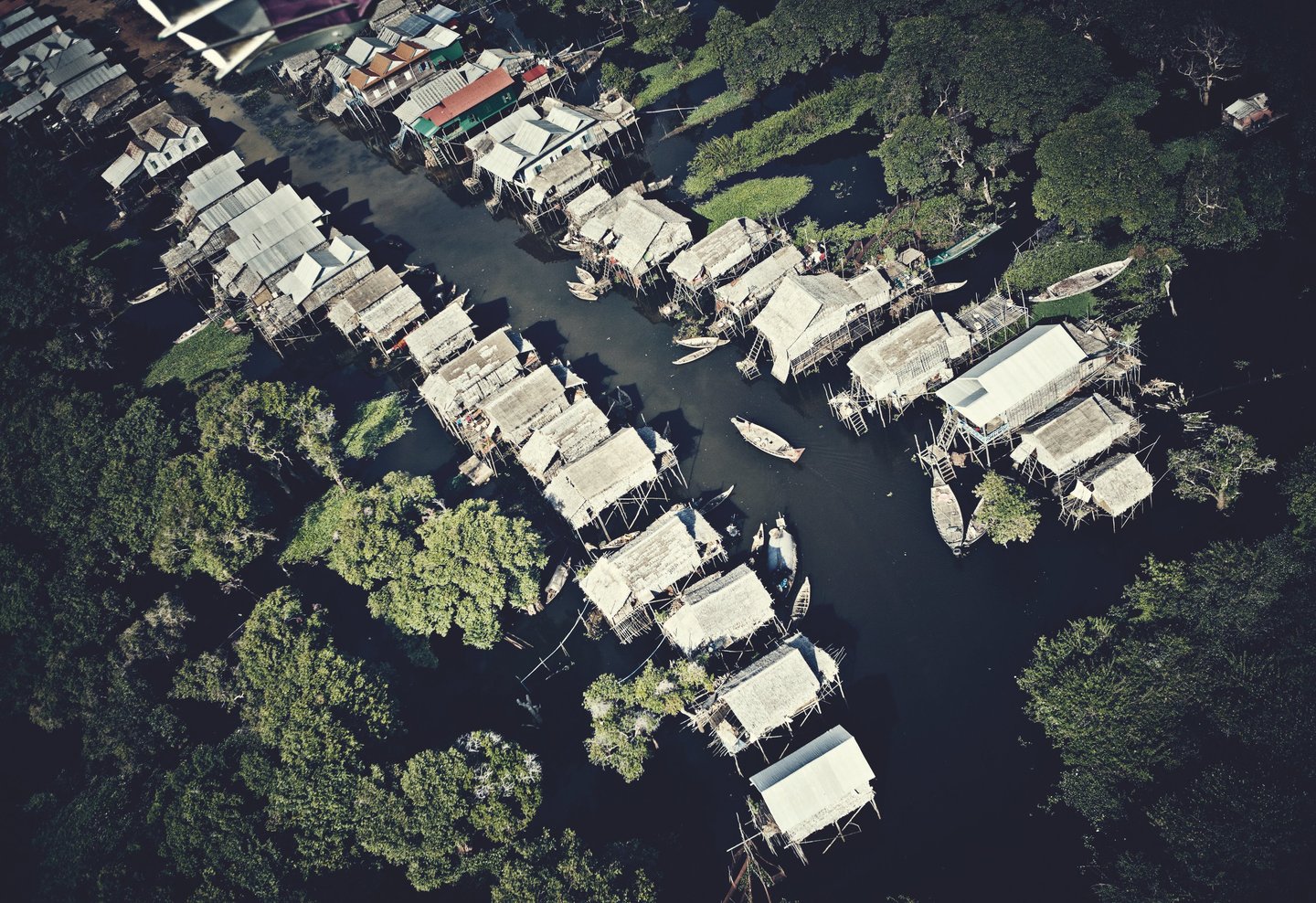
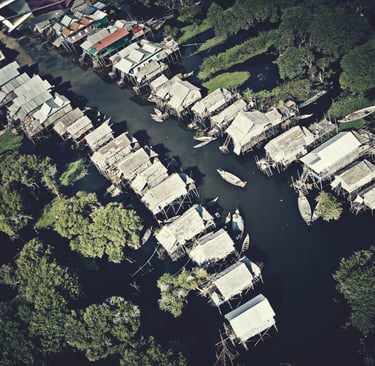
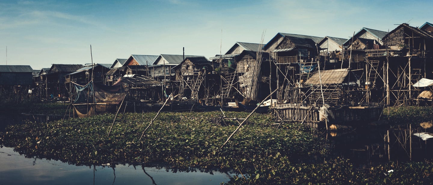
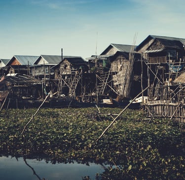
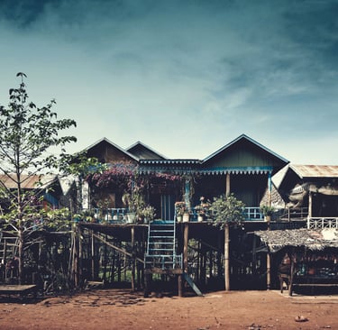
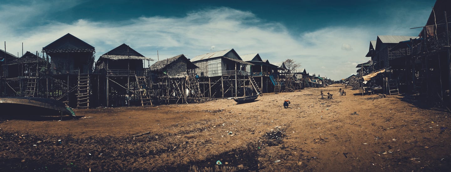
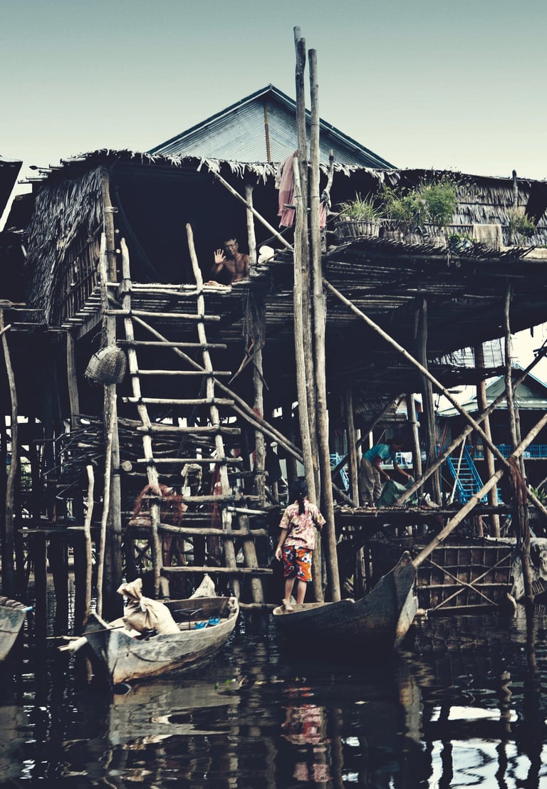
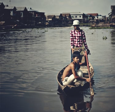
To survive these conditions, the villagers have built their houses on tall wooden stilts, some reaching six to eight meters high. During the dry season, the houses stand far above dusty ground, connected by dirt paths. When the rains arrive, water rises beneath the homes, submerging the land and turning the village into a network of canals. Boats replace walking as the main form of transportation, and daily activities continue on the water. The stilt houses protect families from floods, allow water to flow freely, and provide space below for boats and fishing equipment.
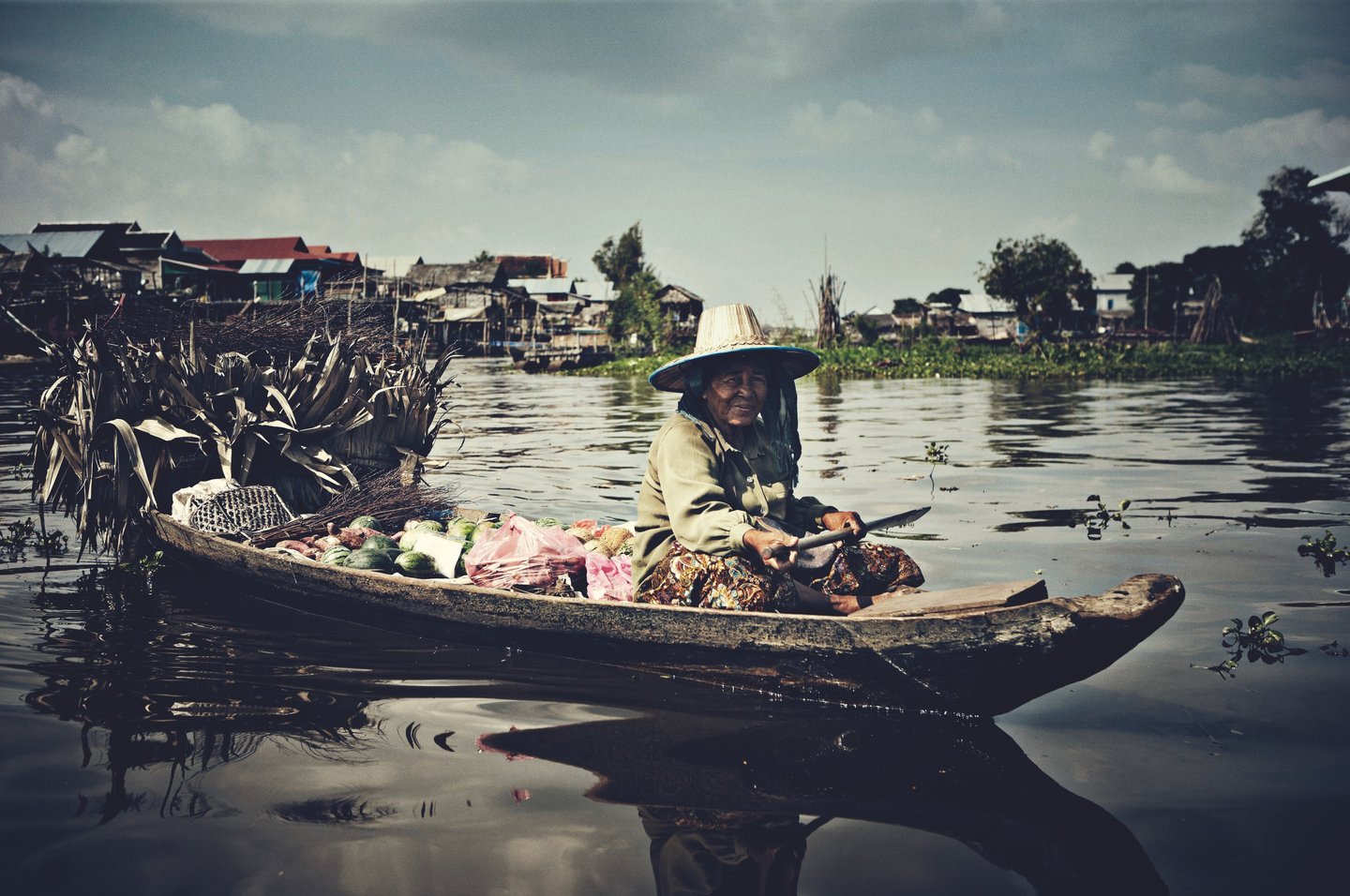
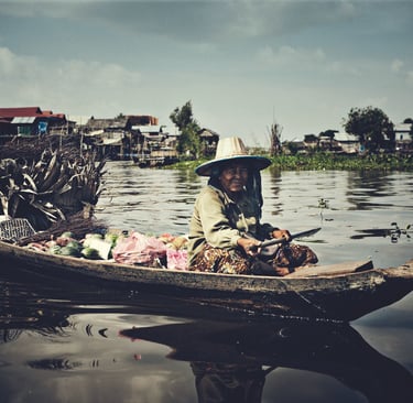
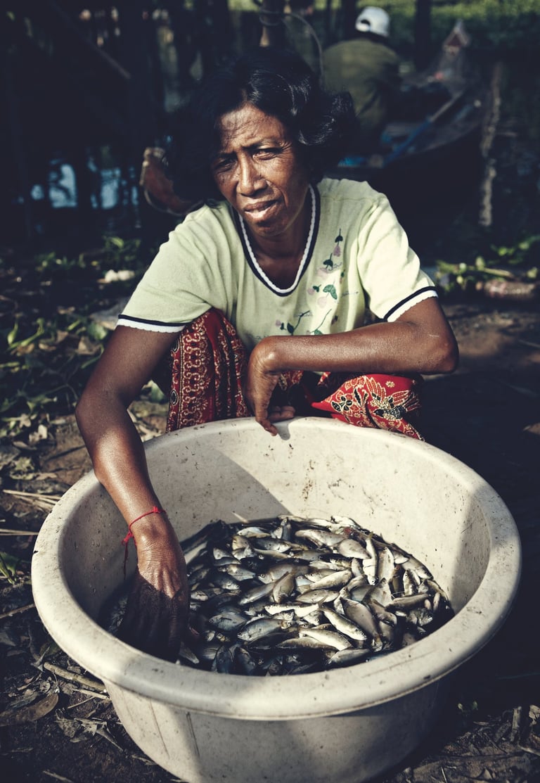
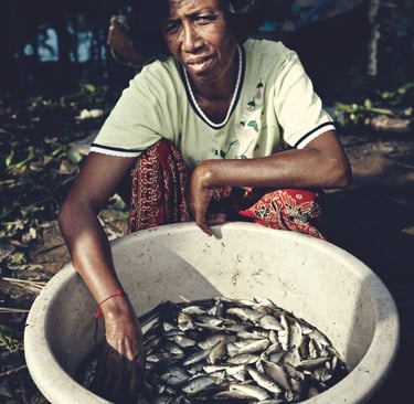
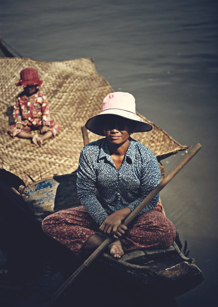
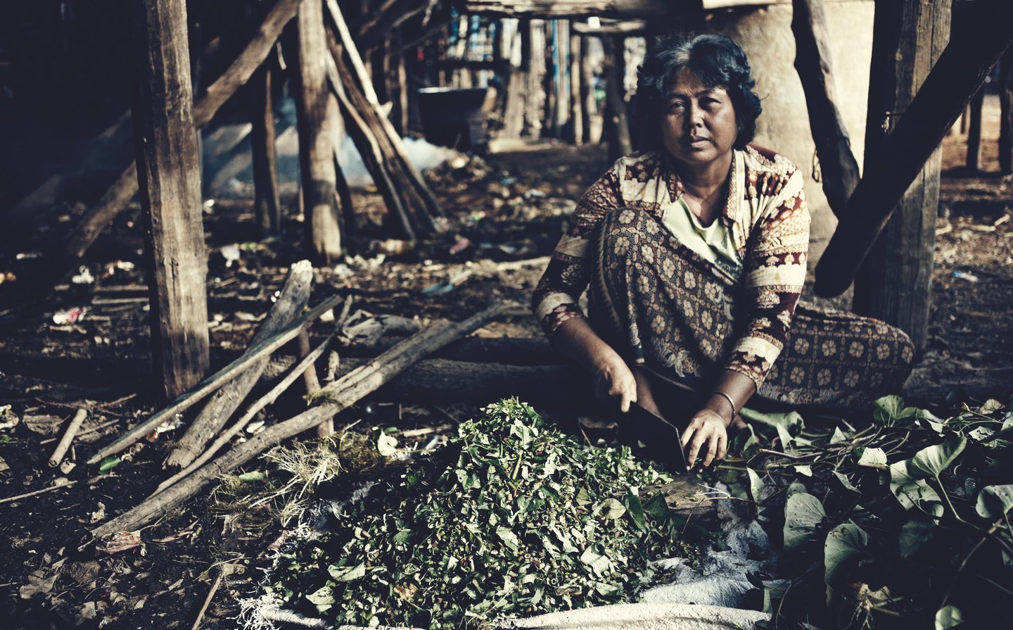
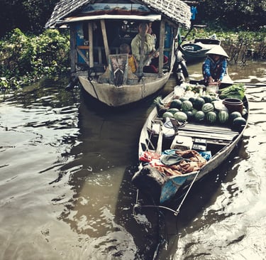
Fishing is the main livelihood in Kampong Phluk. The lake is rich in fish, especially during the flood season when fish migrate into the flooded forests to breed. Families rely on traditional fishing methods, such as nets, traps, and small wooden boats. Fishing is not only an economic activity but also a cultural tradition passed down from one generation to the next. Children learn early how to paddle, mend nets, and understand the movements of fish and water.
Community life in Kampong Phluk is closely tied to cooperation and shared knowledge. Neighbors depend on one another during the flood season, helping with transportation, repairs, and safety. Schools, pagodas, and shops are also adapted to the environment. Some buildings are built on stilts like the houses, while others float on the water. Even children travel to school by boat during the wet season, showing how deeply water shapes everyday routines.
Despite the beauty and harmony of life on the lake, Kampong Phluk faces challenges. Changes in water levels caused by climate change, upstream dams on the Mekong River, and overfishing threaten the delicate balance of the Tonle Sap ecosystem. Economic pressures also push some villagers to seek work outside the community. Still, many residents remain strongly connected to their village and way of life.
Life in Kampong Phluk demonstrates how humans can adapt to nature rather than fight against it. The annual floods of Tonle Sap are not seen as an obstacle but as the source of life and prosperity. In this village, water is not just a surrounding environment—it is the foundation of culture, work, and identity. Through their stilt houses, fishing traditions, and strong community ties, the people of Kampong Phluk continue to live in harmony with the changing waters of the lake.
Kampong Phluk in Tonle Sap Lake
Kampong Phluk in Tonle Sap Lake

Kampong Phluk in Tonle Sap Lake
Kampong Phluk in Tonle Sap Lake
Kampong Phluk in Tonle Sap Lake
Kampong Phluk in Tonle Sap Lake
Kampong Phluk in Tonle Sap Lake
Kampong Phluk in Tonle Sap Lake
Kampong Phluk in Tonle Sap lake
Kampong Phluk in Tonle Sap Lake


Kampong Phluk in Tonle Sap Lake


Kampong Pluk in Tonle Sap Lake

Kampong Phluk in Tonle Sap Lake
Kampong Phluk in Tonle Sap Lake


Tonle Sap Lake
Tonle Sap Lake
Kampong Phluk in Tonle Sap Lake


Kampong Phluk in Tonle Sap Lake
Kampong Phluk in Tonle Sap Lake
Kampong Phluk in Tonle Sap Lake
Kampong Phluk in Tonle Sap Lake


Fish from Tonle Sap Lake


Living on The Tonle Sap Lake
Living on The Tonle Sap Lake


Lunch at the Lake

Crossing the mangroves


Trees in Tonle Sap Lake
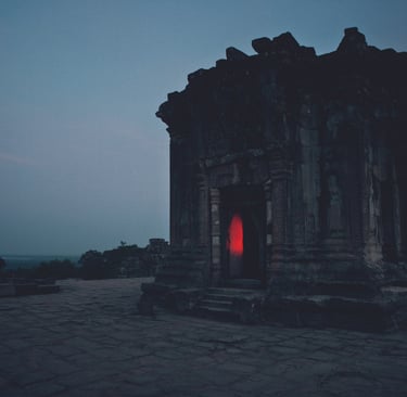
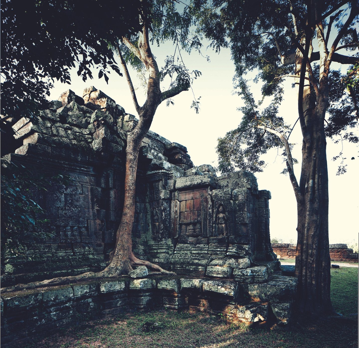
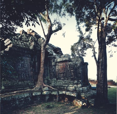
The Temples of Angkor
Historic site of Angkor, Cambodia


Western Gate - Angkor
The Temples of Angkor and the Role of Climate Change in Their Abandonment
The temples of Angkor in Cambodia are among the most impressive religious monuments in the world. Built between the ninth and fifteenth centuries, they were the spiritual and political heart of the Khmer Empire. Temples such as Angkor Wat, Bayon, and Ta Prohm show the artistic skill, religious beliefs, and engineering knowledge of the Khmer people. However, despite its greatness, Angkor was eventually abandoned as a capital. One of the key reasons for this decline was climate change, which placed severe pressure on the city’s environment, economy, and water management system.
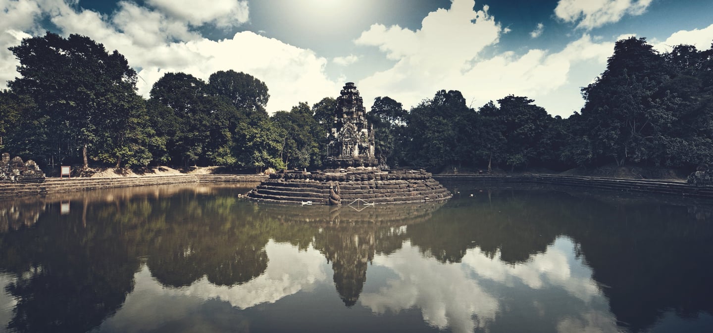
Angkor was founded near Tonle Sap Lake, a region that provided fertile land and abundant water. The Khmer kings built their temples to represent the universe according to Hindu and later Buddhist beliefs. Angkor Wat, for example, symbolizes Mount Meru, the center of the cosmos, while its surrounding moat represents the cosmic ocean. These temples were not only places of worship but also symbols of royal power and stability. Their construction depended on a large population, strong leadership, and a reliable agricultural system supported by water control.
To sustain the city and its temples, the Khmer Empire developed one of the most advanced water management systems of the premodern world. Canals, reservoirs, and moats controlled the seasonal flow of water from monsoon rains. This system allowed farmers to grow rice efficiently and supported a large urban population. As long as the climate remained relatively stable, Angkor flourished, and temple construction continued for centuries.
However, from the fourteenth century onward, the region experienced major climate changes. Scientific evidence from tree rings and lake sediments shows that Angkor faced long periods of drought, followed by episodes of extremely heavy rainfall. These conditions placed great stress on the water management system. During droughts, reservoirs dried up and crops failed. During intense monsoons, canals and embankments were damaged by flooding and erosion. The system, designed for predictable seasonal patterns, could not easily adapt to these extremes.
As the water system began to fail, agriculture declined and food shortages became more common. This weakened the economy and reduced the power of the kings, who relied on control of water and successful harvests to maintain their authority. Without strong leadership and resources, the maintenance of temples and infrastructure became difficult. Some temples fell into disrepair, while others were gradually reclaimed by the surrounding forest.
Climate stress was not the only factor in Angkor’s abandonment, but it intensified existing problems. Political conflicts, shifts in trade routes toward coastal cities, and pressure from neighboring kingdoms further weakened the empire. Over time, the royal court moved south toward the Mekong River region, where conditions were more stable and trade opportunities were greater. By the fifteenth century, Angkor was no longer the capital, and the once-great city slowly emptied.
Although Angkor was abandoned as a political center, it was never completely forgotten. Some temples remained active as religious sites, and local communities continued to live nearby. Today, the temples of Angkor stand as powerful reminders of both human achievement and vulnerability. Their history shows how closely civilization is connected to the environment and how climate change can play a decisive role in the rise and fall of great societies.


Ricefields between temples, Angkor


The Temple of Bayon, Angkor

The Temple of the lake, Angkor
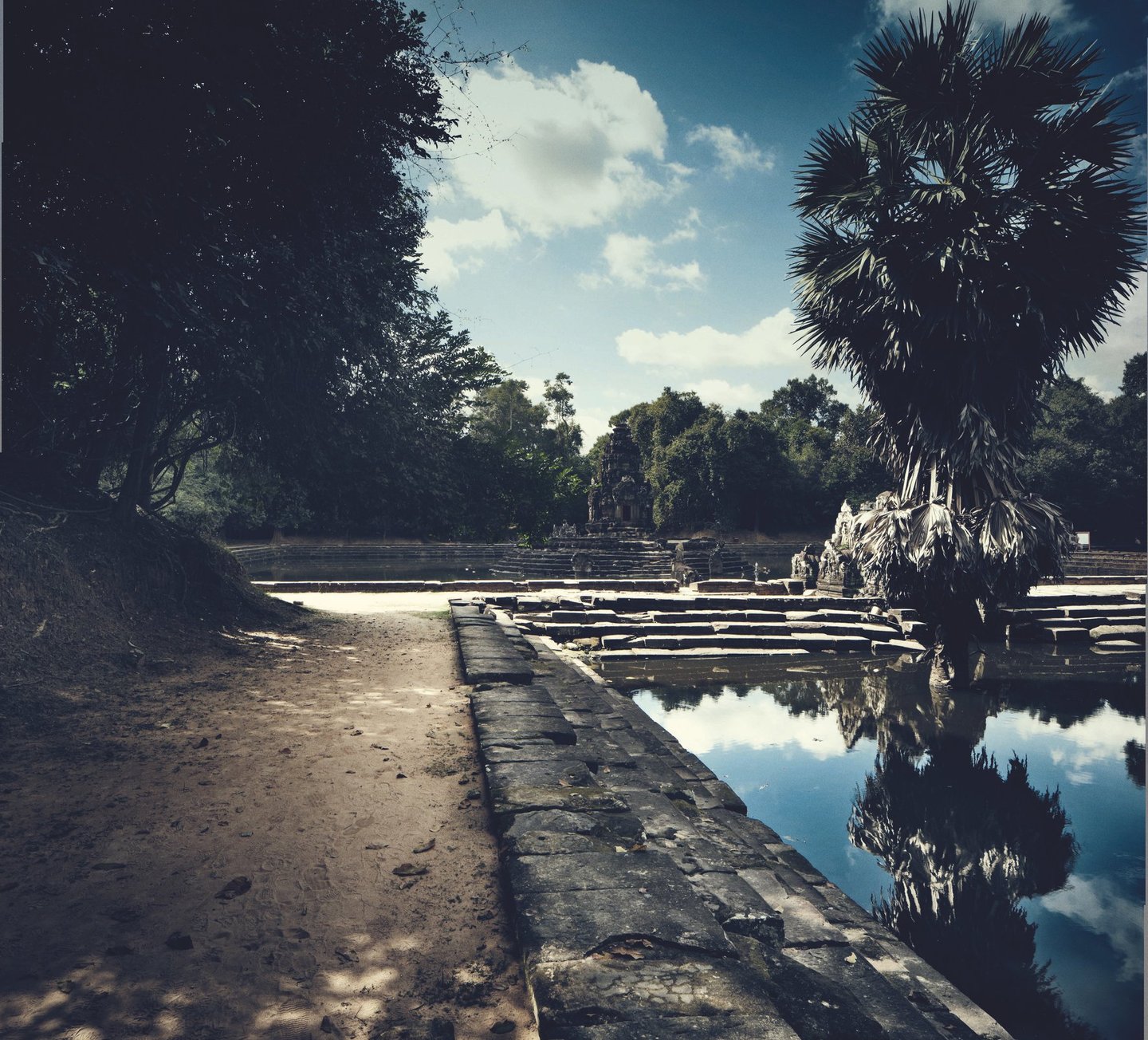

The Temple of the lake, Angkor


Sunrise at Angkor Wat
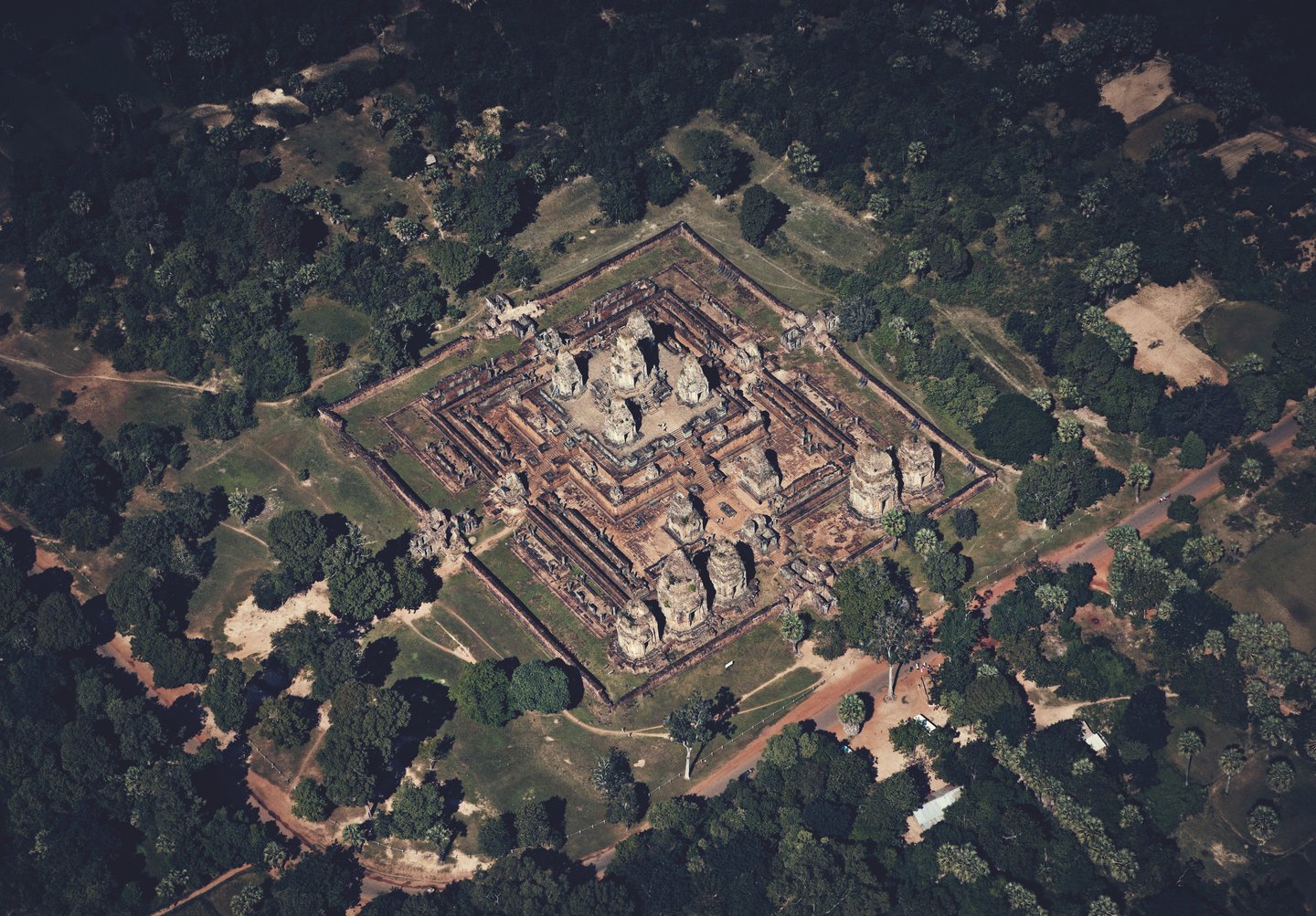
Angkor Wat and Western Baray
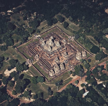
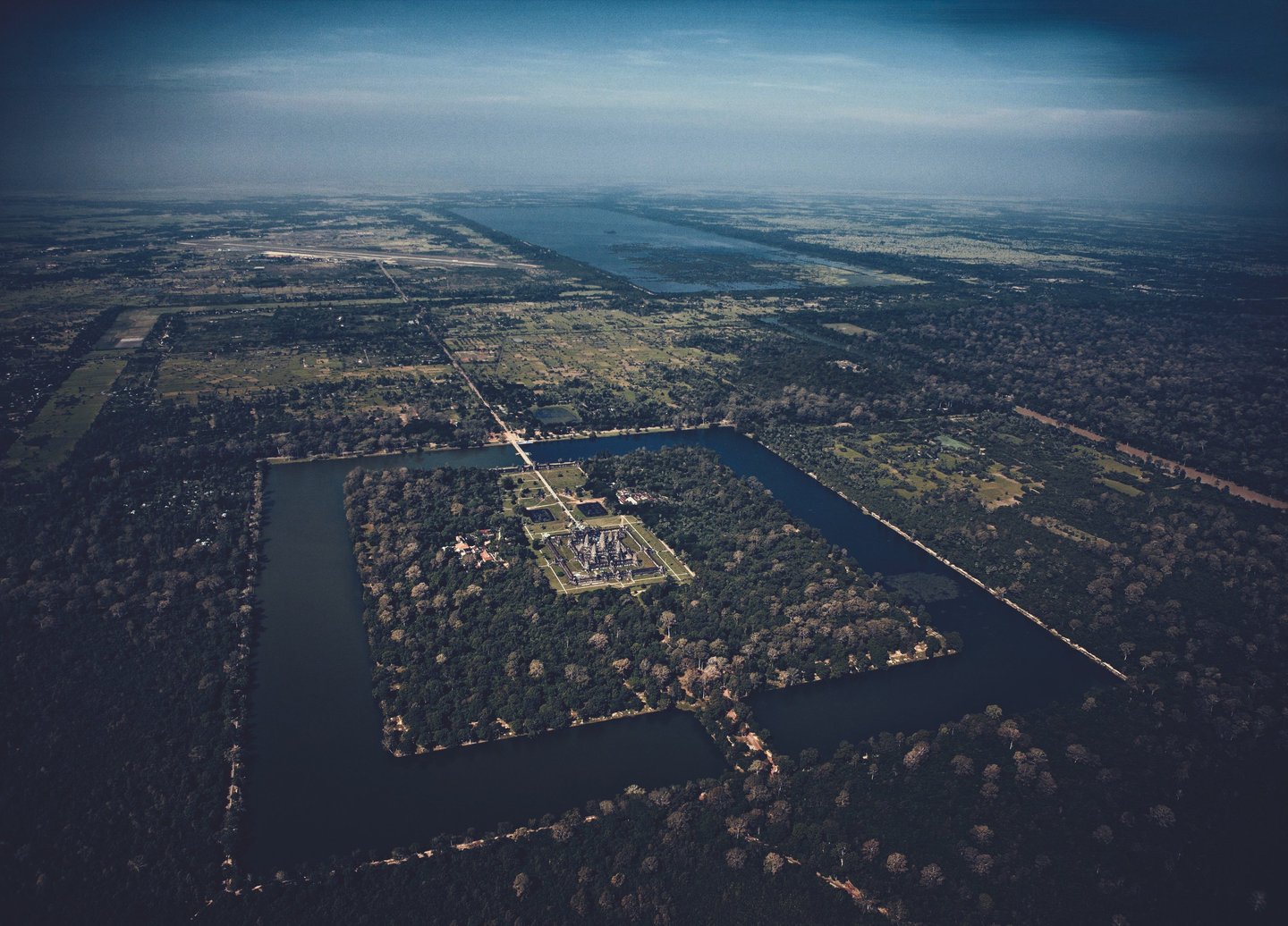
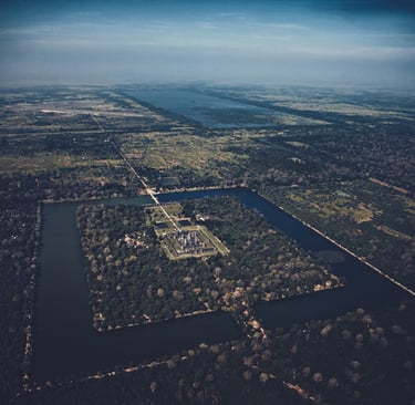
Temple seen from the sky
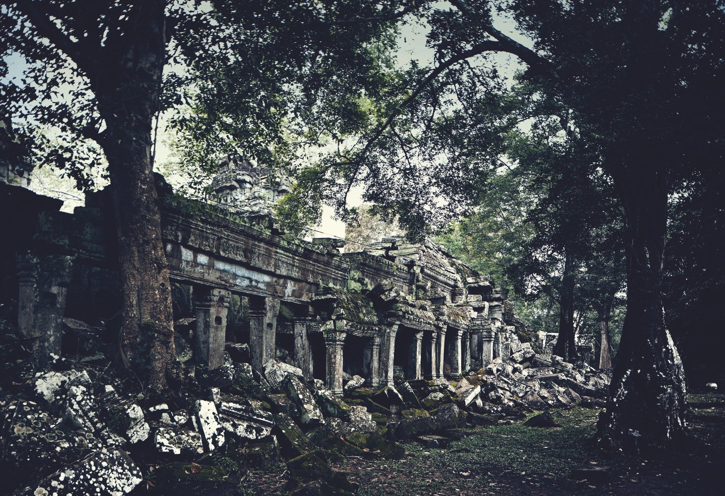
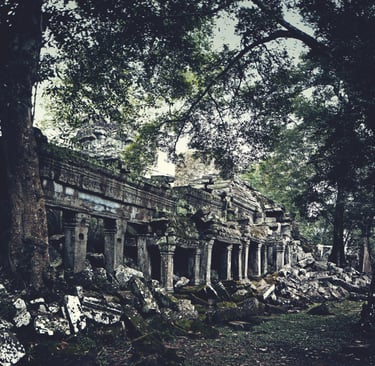
Temple in the forest of Angkor


Corridors of Angkor Wat
Monks of Angkor Wat
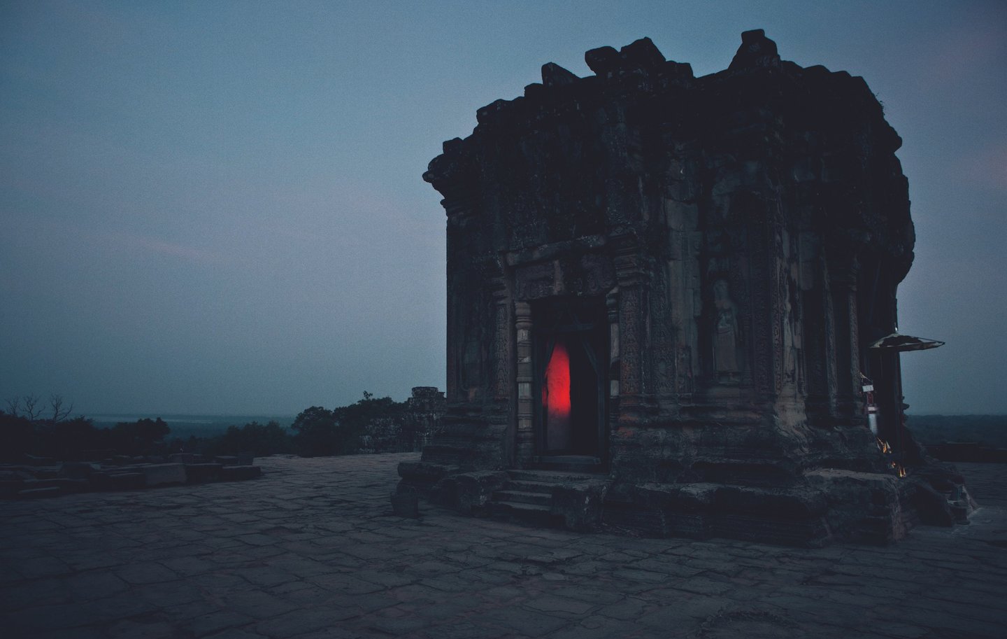
Temple on the Hill, Angkor


Temple in the Forest
Sunrays in the Temple


Eastern Baray, Angkor


Eastern Baray, Angkor


The Moat of Angkor Wat


Angkor Wat


Temple Gate, Angkor
The Temple of Bayon, Angkor
The Corner Temple of Angkor
The Monks of Angkor
Serenity in colors


Apprentice


Young Monk in Kampong Phluk


Lunch in the Monastery, Angkor
Monsoon